
The question we hear most on a first call is where to buy. It almost always arrives as "which is the best area?", and the conversation moves forward once we swap it for another: what do you want the property for.
On September 15, 2026 we read in full five area guides that appeared among the top search results, in English and Spanish: BuyPlaya, TheLatinvestor, HolaNeo, Reference Real Estate and VentasPlaya. All of them describe the feel of each neighborhood, and TheLatinvestor is the only one that names the source of its figures. None of the five mentions the city's urban development program or the land use certificate, the two documents that say what can be done on a specific lot.
How to read the city before you look at neighborhoods
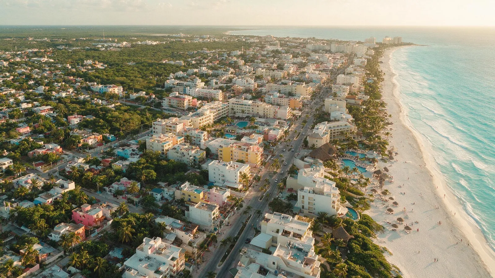
Playa del Carmen is laid out on a grid, and understanding it saves weeks of driving around. Avenues run parallel to the sea and climb in number as you move inland: Quinta, which is largely pedestrian, then 10th, 15th, 20th and the ones that follow to the west. Streets cross them at right angles; north of Avenida Juárez they are even numbered and south of it, odd. Ferries to Cozumel leave from the Calle 1 Sur terminal.
Cutting across everything is Federal Highway 307, the line that matters most in the city. East of it you walk to the beach; west of it you depend on a car or a colectivo for almost everything. Crossing it changes the tenant profile and how easy it is to resell, and it is the first thing we check when we value a unit.
Five filters before you pick an area
These are the five filters we check in the closings we work on.
Use. Living there year-round, coming for three weeks and renting the rest, long-term rental to residents, or holding value without operating anything. Each use favors a different area.
The condo bylaws. Short-term rental is decided by the building's bylaws, and on a single street some towers allow it and others prohibit it. Ask for them before you put down a deposit. The registrations and taxes that come next are in our live-and-rent guide.
The lot's land use. It is set by the urban development and ecological zoning programs in force, and a municipal certificate proves it. We explain both in the next two sections.
Your nationality. Playa del Carmen is inside the 50-kilometer coastal strip where a foreigner cannot acquire direct ownership, so for residential property the purchase goes through a bank trust in any neighborhood; for non-residential use, the Foreign Investment Law also allows a Mexican company. The full process is in our bank trust guide.
The origin of the land. Much of the city comes from ejido land, and the file has to show that stage is closed.
What the urban development program says
Quintana Roo's Secretariat for Sustainable Urban Territorial Development lists the Urban Development Program for the Playa del Carmen Population Center with a date of December 20, 2010. The same list includes partial programs, such as the one for the city's far south (2013), that govern parts of Playa. The document itself says the program in force when it was drafted had applied since April 2002 and that the city's growth had brought irregular settlements and incompatible land uses.
The program divides the city into zones with a code, and each code carries its own density, coefficients and height. Three examples from the text show how much changes between them:
- H1a-U, low-density residential. Single-family, 10 homes per hectare, 600 square meter minimum lot, land occupancy coefficient of 0.35, land use coefficient of 0.70 and no more than two stories or 7 meters.
- H4-U, high-density residential. Single-family, 60 homes per hectare, 110 square meter minimum lot, occupancy of 0.45, use of 1.20 and no more than three stories or 10.5 meters.
- CU, urban center. 60 homes or 100 rooms per hectare, occupancy of 0.70 and use of 2.0. Mind the name: it includes the La Cruz Urban Center polygon, where City Hall sits, far from Quinta.
In tourist zones density is also measured in rooms. Code TR1-U, also single-family, allows 10 homes or 20 rooms per hectare, and the program defines a room as a standard lodging unit with one or two beds and a bathroom, or a suite with a living and dining area. In residential zones H1 to H4, the solarium, up to 20% of covered surface with a non-permanent structure, cannot be used for residential purposes or for temporary or permanent lodging.
Some zones are not regulated in the program itself and are referred to another instrument. For the lot with code TR3b, the rules are in the Playacar Phase II Development Master Plan, issued by the Secretariat of Social Development under Condominium Regime License No. 8005/96, dated November 8, 1996. The La Cruz Urban Center polygon, made up of superblocks 51, 52, 53, 54, 48, 58 and 63, has its own Master Plan with lot-by-lot parameters.
To authorize urbanization, building and condominium works, the program requires, among other conditions, that the land use or purpose not differ from the one set in the applicable program and the corresponding declarations. That is why the zone that matters is the lot's, and one neighborhood can hold several codes. We are not going to assign a code to each neighborhood in this guide: that reading is done on the zoning map and each lot's file.
The land use certificate and the program update
The document that proves a lot's use is the Constancia de Uso de Suelo, procedure MPDC-SOT-DDUYF-SPU-CUS-022 of the municipal Urban Development and Townscape Directorate (Dirección de Desarrollo Urbano y Fisonomía). The official procedure page says it is requested when a citizen wants certainty about the land use or purpose set for their property by the urban development and ecological zoning programs in force, along with its coefficients, setbacks and permitted height. Three details from that page change how you use it:
- The response time is up to three months, and if there is no answer the negativa ficta applies: the authority's silence counts as a no.
- Validity is indefinite, tied to that of the urban development plan, and the page warns that if the urban planning instrument is modified, it must be requested again.
- For a condominium unit, the requirements include a document from the condominium assembly or technical committee stating its parameters and restrictions, plus a copy of any master condominium regime.
The second point matters now. On June 18, 2025 the city announced progress on updating the program, with public workshops aimed at concluding on December 23, 2025 and later approval by the City Council. As of September 15, 2026 we did not find the new program published, so we make no claim about which codes will change. In a presale, ask for the lot's certificate with its date and ask the developer whether the update affects it.
The areas, one by one
Centro and the Quinta Avenida corridor
The most established part of the city. You walk to the ferry terminal, the bus station, supermarkets and private hospitals, and a vacation rental guest does not need a car. What you pay is noise: Calle 12 and its surroundings run until the early hours, parking is hard, and Quinta fills up in high season. For living there year-round with kids and a car, it is rarely the best answer.
This is where we have direct representation: BUZZ, on Calle 28, is a project of combinable modules in presale from 2,000,000 pesos, steps from Quinta and the sea. You can see the full development.
Gonzalo Guerrero
North of the center, between Quinta and 30th Avenue. The beach is still walkable, with less noise at night. A lot was built here very fast, and the difference between a well-built building and one with damp, weak water pressure or absent management is checked in the owners' meeting minutes, the state of the fees and a visit when it rains.
Zazil-Ha and Coco Beach
Newer buildings and a residential feel on the expensive part of the northern coast. It draws people who want to be near the sea without sleeping on top of the nightlife. You depend on a car more than in the center, and short-term rental rules change from tower to tower.
Playacar, Phase I and Phase II
A gated community with a golf course and tree-lined streets. Our office is in Playacar Phase II, so we say this first hand: it has the most orderly daily life in Playa. In exchange, high maintenance fees and strict rules. On Phase II lots coded TR3b, construction parameters come from the Master Plan the program cites, so that document belongs in the file.
Colosio
North, on the east side of the highway, with a lot of new vertical construction. It works for long-term rental to residents and for entering the market without coastal prices. On July 17, 2026 the city reported the delivery of 474 property titles and 30 deeds to families in the neighborhood, and the governor said the delivery ends more than three decades of uncertainty over their property. Before you buy there, confirm the lot's title is recorded in the Public Property Registry.
West of the highway, including Ejidal
Low entry prices and new construction, with the weakest tourist demand in the city: in what we have operated west of the highway, the tenant is local and on a yearly lease. The file matters more here than anywhere else. Speaking of the whole population center, the program says most of the land was originally ejido land and that, although almost all of it is now private property, scattered ejido lots remain, mainly in the growth area, along with private lots that came from expropriation. One way out is article 82 of the Agrarian Law: once the assembly has resolved under article 81, an ejidatario may take full ownership of their parcel; the National Agrarian Registry removes it from its registry and issues a title that is recorded in the Public Property Registry, and from that cancellation the land stops being ejido land. The file must show whichever route applies. If you are looking at presales, also read our presale guide.
Corasol and the north toward Xcalacoco
International buyers, scarce units and fees to match. It is a purchase for holding wealth, and resale depends on a smaller pool of buyers.
The neighborhood figures in circulation
TheLatinvestor publishes price per square meter by neighborhood and names where it takes it from. Use it as a reference for asking prices, which is what it measures. HolaNeo publishes unsourced price per square meter ranges and VentasPlaya unsourced double-digit annual appreciation, so we do not repeat them.
No neighborhood figure tells you what your unit will earn. Yield is decided by the building's bylaws, the lot's code, the management and the expenses, and two towers on the same street produce different results. The breakdown of expenses and taxes is in our Airbnb ROI guide.
Sargassum, noise and traffic
Sargassum reaches the whole open Mexican Caribbean coast and no neighborhood is immune. What changes from one stretch to another is who cleans it and how consistently. If someone sells you an area by saying it never arrives there, treat that as a warning sign. Noise concentrates in the downtown corridor and traffic at the highway crossings at rush hour. Neither shows on a Tuesday noon visit, so go back at night and on a weekend.
When we tell a client an area is not for them
When the use and the area cannot be reconciled. If the plan is short-term rental and the building's bylaws prohibit it, no negotiation fixes that. If the plan is family life and the budget only reaches the Calle 12 area, we would rather show Colosio or the west side. If a development cannot show the lot's land use certificate or a closed regularization, we do not bring it to the table, however good the presale looks. The full list of warning signs is in our fraud guide.
We are master brokers in four cities and work with third-party inventory as well as our own, so we can recommend what fits even when it is not ours.
Next step
Browse the available inventory, compare towns in our Playa del Carmen vs Tulum guide and follow the order of a purchase in our buying process guide. Or write to us through the contact form and we will put together a comparison of two or three areas with each lot's file.